
Land Use and Zoning 101: The Future Land Use Map
This is part two of a series on Land Use and Zoning 101. Read part one here.
A previous blog post gave an overview of the City of Raleigh’s 2030 Comprehensive Plan. The Comprehensive Plan is a document used by the City to guide its future growth and development. This post covers one chapter of the Comprehensive Plan you may be familiar with; the Future Land Use Map or FLUM. We have a FLUM because North Carolina law (General Statute 160D-501) tell us:
“As a condition of adopting and applying zoning regulations under this Chapter, a local government shall adopt and reasonably maintain a comprehensive plan or land-use plan.”
Because the City of Raleigh has zoning, state law requires it to have a Comprehensive Plan or land-use plan. Raleigh's Comprehensive Plan is where the land-use plan lives. We will get into depth on what zoning means in the next post. Zoning is the local law that controls what can be built and where it can be built. Zoning also controls how tall buildings can be, where different types of businesses are allowed and much more. As Raleigh grows and changes over time, zoning can change along with it. The process of changing the current zoning of property is called “rezoning.” The rezoning process can be complicated so we will discuss it separately.
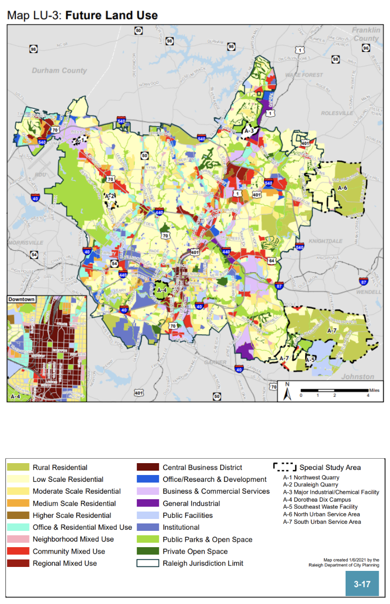
When a property is rezoned, North Carolina state law states that the proposed zoning should be consistent with the Comprehensive Plan. One component of that plan is the Future Land Use Map, or FLUM (shown on the right). The FLUM is in the Land Use Chapter of the Comprehensive Plan. Every piece of land in Raleigh has a designation on the FLUM.
The Land Use Chapter of the 2030 Comprehensive Plan is one of fourteen chapters. When a piece of land is rezoned, the entire Comprehensive Plan is evaluated as a part of the process. The Land Use Chapter of the Comprehensive Plan states:
“The Land Use Section of the Comprehensive Plan provides the critical foundation upon which all other elements are based.”
The goal of this chapter is to guide future growth efficiently. Efficient growth means considering the cost of new development. New development will provide people with places to live, run errands and enjoy. But new residents will also use more City resources like water, sewer, fire and other basic City services. The goal of the Land Use Chapter of the Comprehensive Plan is to coordinate City services so every resident can have equal access to them. The FLUM is one tool used during the rezoning process. The FLUM has categories shown on the map in different colors that guide what should be built where. This map represents what the future zoning should be as the City’s needs grow and change. The goal is to help development grow harmoniously with the community. The next blog post will explore what zoning is, and an introduction to how it changes; read it here.